K
Kathleen Martin
Guest
Two N.C. Department of Transportation programs combined to be the first in the nation to launch an innovative technology pilot with their safety service patrol that should improve safety on North Carolina roadways.
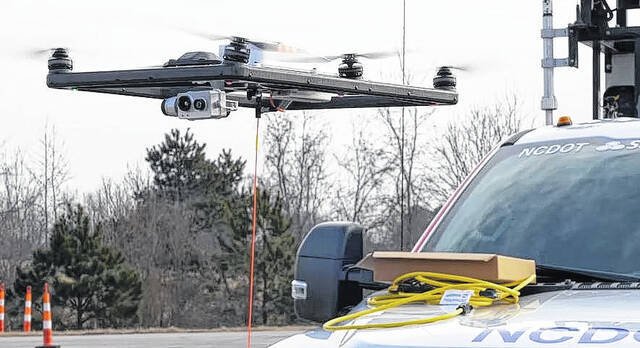
The statewide Incident Management Assistance Patrol (IMAP) program and the Division of Aviation’s Unmanned Aircraft System program recently helped develop and deploy the operation of tethered drones from select IMAP vehicles.
This helps responders assess incidents, provide situational awareness to the NCDOT Statewide Transportation Operations Center and Traffic Management centers and assist with overall traffic management of the incidents. The deployment of this technology was realized as a result of a federal innovation grant received in 2020.
“Along our interstates, where our IMAP patrols operate, there are gaps in camera coverage, so we don’t have perfect situational awareness,” said State Traffic Operations Engineer Dominic Ciaramitaro. “Our tethered drones will help us fill those gaps.”
Traditionally, traffic operations staff views video feeds at the NCDOT Statewide Transportation Operations Center and Traffic Management centers through traffic cameras or they receive reports from responders in the field. Tethered drones safely offer another method to provide more information in real time, with higher quality video, and for long periods of time.
IMAP trucks are equipped with multiple specialized tools to assist stranded motorists or scene management with first responders. The tethered drones will be just one more resource in their toolkit.
Each drone can fly up to 150 feet to take video, which is livestreamed to the Transportation Operations Center, traffic management centers and to emergency management personnel at the incident.
This instant information can provide a safer environment for those on scene or approaching an incident and allow the centers to better manage traffic and share more accurate traveler information to the public. The systems are highly portable and can be quickly launched and recovered.
Continue reading: https://www.robesonian.com/news/154404/ncdot-launches-national-first-with-tethered-drones-on-imap-trucks