K
Kathleen Martin
Guest
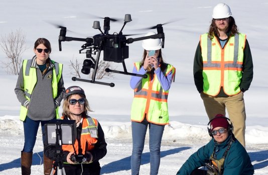
Rapidly spinning propellers created a low humming sound as a drone prepared for flight Friday.
The unmanned aircraft flew up about 60 meters to document the debris and devastation the white snow almost hid from sight.
The drone moved back and forth, capturing images of the rubble where homes once stood.
The drone is a key tool experts from the University of Colorado Boulder, Oregon State University and Purdue University are using to study the Marshall Fire burn site. The project is a co-led study by CU’s research group, Resilient Infrastructure With Sustainability and Equity, and the Geotechnical Extreme Events Reconnaissance. The study and the GEER team are both sponsored by the National Science Foundation.
The project started Thursday and will go through Monday, said Brad Wham, an assistant research professor at the University of Colorado Boulder’s Civil, Environmental and Architectural Engineering Department. Wham is part of the RISE group as well as the GEER team.
After all five drones being used for the project have finished photographing areas in the Marshall Fire burn site, the pictures will be pieced together to create a 3D image of the burn site.
“You follow an overlapping pattern, circle around and come back the other way to be able to build a mosaic of the area with a high-quality image,” Wham said.
Researchers with GEER have studied earthquakes, floods and tsunamis for years. This is the first time GEER has deployed researchers to study a wildfire, said Erica Fischer, civil and construction engineering assistant professor at Oregon State University. Fischer was deployed to Colorado as part of the research team.
Continue reading: https://www.dailycamera.com/2022/01/30/marshall-fire-the-university-of-colorado-boulder-co-leads-aerial-drones-project-to-study-impacts-of-fire/