A partnership, which marries Ascent AeroSystems’ coaxial unmanned aerial system technology with Exyn Technologies’ LiDAR-enabled mapping software, is expected to provide a new solution for customers seeking to operate drone systems in confined spaces and in GPS-denied environments.
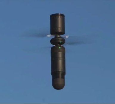
The partnership, announced in August, will equip Ascent’s Spirit compact, coaxial aerial platform with Exyn’s LiDAR system and autonomous software stack, enabling the capture of 3D mapping data in environments inaccessible to other UAV systems.
The two companies had been working together for about nine months before announcing their agreement, said Paul Fermo, Ascent’s vice president of business development. Exyn’s software technology creates a three-dimensional LiDAR point cloud that allows operators to build a 3D picture in GPS-denied environments, he said.
“It’s a great technology that’s adaptable to our system, so you have all the benefits of the coaxial drone with the autonomous software stack and LiDAR that Exyn provides,” Fermo said.
Continue reading: https://dronelife.com/2021/09/23/ascents-coaxial-drones-now-with-exyns-lidar-enabled-mapping-software/