K
Kathleen Martin
Guest
The entire country of Lebanon was changed forever when a large amount of ammonium nitrate stored at the Port of Beirut exploded on August 4th, 2020. The $15 billion in property destruction that it caused was the least of that damage, as the hundreds dead, over 7,000 injured and the estimated 300,000 people that were rendered homeless signify the true catastrophic nature of the event.
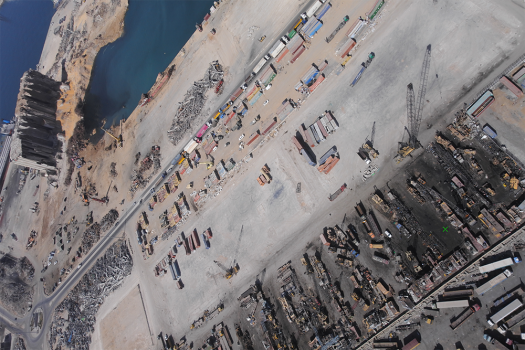
In the midst of this tragedy, experts from a handful of companies came together to use data captured by drones to create a 3D map of the area most affected by the explosion. Developed on a “Pro Bono” basis that have made these assets available to anyone, these 3D models of the area allowed first responders to take decisive action and literally save lives. The detailed and accurate open-access map of the blast area and surrounding damage to the city bolstered rescue and recovery efforts on multiple levels.
The 2D and 3D maps and surveys that were created with data captured by drones made a major difference in Beirut but these models have also highlighted what kind of possibilities these sorts of assets can enable. 3D models can be utilized for blast modeling, flood modeling, damage assessment, automated structural damage assessment, urban planning, infrastructure planning and more. However, the true power of 3D maps is something that many are just beginning to truly understand.
Continue reading: https://www.commercialuavnews.com/public-safety/3d-models-from-drone-data-support-disaster-efforts-and-define-city-mapping-possibilities

