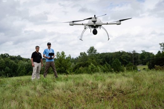
Allen Geomatics helps compare the differences between traditional and Drone LiDAR surveying methods
Rome, NY- Down to Earth, a surveying reality series, heads into the woods of North Carolina to compare traditional and drone surveying methods on a 15-acre design survey for a development project. In these 4 informative episodes, Allen Geomatics, a land surveying, and consulting firm located in Advance, NC, utilizes a 3 man crew to collect their ground shots and survey the site while Robert Chrismon, PLS, takes a different approach high in the sky with Drone LiDAR.
To see the results and learn about the differences between the two surveying methods CLICK HERE
“Down to Earth” is a reality series that shows how real surveyors collect data and turn it into real deliverables, despite challenging terrain, rough weather, and hidden dangers.
These days, many surveying professionals are considering adding drone surveying equipment to their toolbox. In these episodes of Down to Earth, we meet Jeff Allen, owner of Allen Geomatics P.C., a land surveying and consulting firm located in Advance, NC, who is also curious to see if drone surveying methods can enhance his practice.
Continue reading: https://www.suasnews.com/2021/10/boots-on-the-ground-or-drones-in-the-air/