K
Kathleen Martin
Guest
Four million miles of roadways, 600,000 bridges and 350 tunnels. Two million one-hundred thousand farms. More than 4,000 U.S. public safety agencies fielding drone programs. Damage estimates for insurance companies and safeguarding against school shooters. UAS are an intrinsic part of supporting and protecting critical infrastructure in America.
Take, for example, the unmanned systems that came to the rescue when an aging dam in Florida, the only barrier holding back lead and nickel-poisoned water from flooding a nearby town, required inspection. Sending divers into toxic water was not an option. Draining the dam would have been prohibitively expensive. Triad Drones, a Safety Harbor, Florida-based company making waves in the dam sector, used its unique unmanned and networked air, ground and subsurface vehicles, with multibeam sonar, to provide predictive structural integrity and volume analysis.
This is but one of hundreds of similar drones-in-infrastructure stories increasingly happening across the country on a daily basis. (By the way, the inspection proved the dam was good to go for a few more years).
The U.S. Cybersecurity and Infrastructure Security Agency (CISA) outlines 16 sectors with assets, systems and networks it considers vital. Drones support nearly all of them (the possible exception is the cyber-based information technology sector). Inspections dominate drone services, but drones also assist with disaster response, construction monitoring, facility disinfecting, marketing and more.
Because drones have proven efficient, effective and economically sound, various models have arisen that allow UAS pilots to plug into these business opportunities, now and in the future. This article reviews the critical infrastructure (CI) sectors (a few are combined) and highlights drone applications in them. A “Remote Pilot Roundup” chart provides a tabular roadmap for these RPs to plug into this lucrative market.
Food and Agriculture
Almost 100% civilian-owned, the entities in this category includes an estimated 2.1 million farms, 935,000 restaurants and more than 200,000 registered food manufacturing, processing and storage facilities. This sector accounts for roughly one-fifth of the nation’s economic activity.
Using GPS technology with GIS (geographic information system) tools, the worldwide precision agriculture market is estimated to reach $4.34 billion by 2025. Augmented by drones, this market will almost double, to the tune of $8.2 billion by 2026, according to one market research report.
Contracted remote pilots that work with Utah-based company DroneHive are flying more than 100,000 acres of farmland during 2021 in support of virtual agronomy, CEO Paul Huish said. “Data collection is the end product we provide to farm managers, who do the analytics, reporting and processing,” Huish said. “Precision agriculture use of drones has significantly expanded. Farmers are scaling and producing in large volumes. This drives an increased demand for crop data.”
Energy
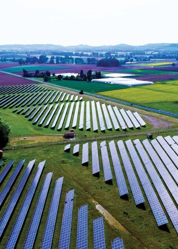
Including both fossil and renewable fuels, the 80% private-owned energy sector is also massive. The electricity segment alone includes more than 6,413 power plants.
Energy companies commonly use drones for GIS data collection. Bill Swope, geospatial and survey business development manager for Halff Associates, Inc. in Richardson, Texas, leads the company’s drone team in inspecting energy, transportation and water sector facilities. Oil and gas companies traditionally gathered data from the ground; his team collects geospatial data using drones for aerial shots and combines that data with mobile LiDAR from sensors on vehicles and terrestrial scans from a tripod.
Continue reading: https://insideunmannedsystems.com/opportunity-spotlight-drones-are-critical-to-infrastructure/

